Yorkshire 3 Peaks - May 2024
The Yorkshire 3 Peaks is a popular 38.6km route which takes walkers, dawdlers, and amblers alike over the peaks of Pen-y-Ghent, Whernside, and Ingleborough. While some try to walk the whole endeavour in a single day, Abbie and I decided to do it in two, and make it a camping trip. While we weren't in as much of a rush as a result, we did have to lug around our tent and other kit.
Route
We actually did the route in reverse to the typical order, starting with Ingleborough and finishing with Pen-y-Ghent. I recorded the whole thing on Strava and this was the route we took:
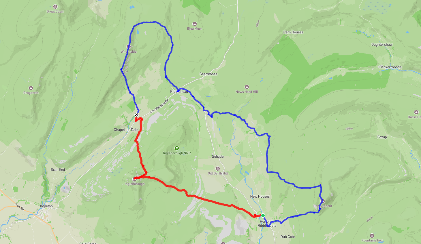
The orange route was the first day, and the blue the second.
The raw .gpx file can be downloaded here, although I'm sure there are many more available online which are smaller and more accurate.
Day 1 - Ingleborough
We intended on parking in the Yorkshire Dales National Park Car Park in Horton in Ribblesdale, but it was full to the brim. Luckily the field just over the bridge had been opened up as an overflow carpark, with a fee of \(£5\) or so.
The first summit up Ingleborough was bleak. I won't sugar coat it. The start was alright up to the train station and over the first few hills. We were passing loads of ultra-marathoners who were finishing a race of all three peaks; some looked like they were having the time of their life, and others looked like they were on the edge of death. Once we started gaining some actual altitude on the mountain face, we started to share in their pain. The wind picked up and so did the rain - a consistent theme throughout: sodden soaking wetness! We were slugging our way up whilst earning a new appreciation for shelter. It's like when you get sick and regret taking it for granted when you're healthy, except we regretted taking for granted all the times we had a wall to stop the sodding wind and rain from being blown into our eyes. To further dampen our spirits, we were passed by a rescue team coming down with somebody on a stretcher. I assume it was one of the marathoners who, in his exhaustion, stepped on a rock which looked a lot more solid than it felt... We flattened ourselves against a wall about halfway up to eat our lunch before continuing up to the summit. The summit which was, like any other fine English day, was completely blanketed in cloud and mist. The path to the actual summit beacon was also uncharacteristically ambiguous, I was essentially relying on OpenStreetMap (which is a lot better than a lot of other maps providers in terms of listing footpaths and walkways by the way) to plot a course. That must be what pilots feel like when flying with no visibility - just trusting their instruments. At least we had a gradient under our feet to keep us moving along. There were loads of people at the top, many of whom obviously belonged to some group excursion. We didn't stick around though and to get out of the mist, we headed straight down to the campsite. The descent was a lot more cheery than the ascent, we were better sheltered, the rain had stopped (but the wet grass still left our feet swimming), and we were greeting lots of cheery passers-by.
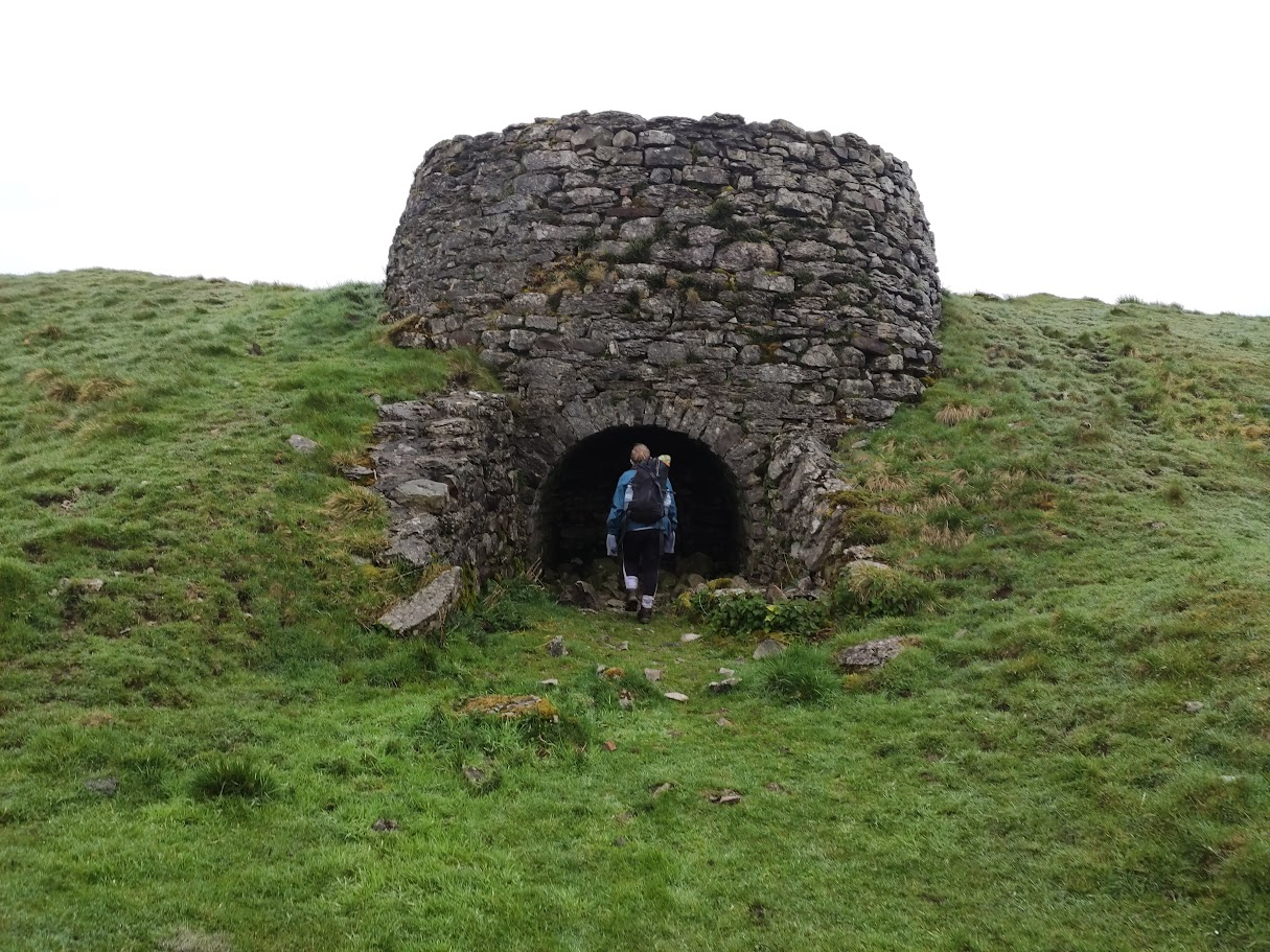
Abbie entering an old lime kiln - used to produce quicklime from limestone.
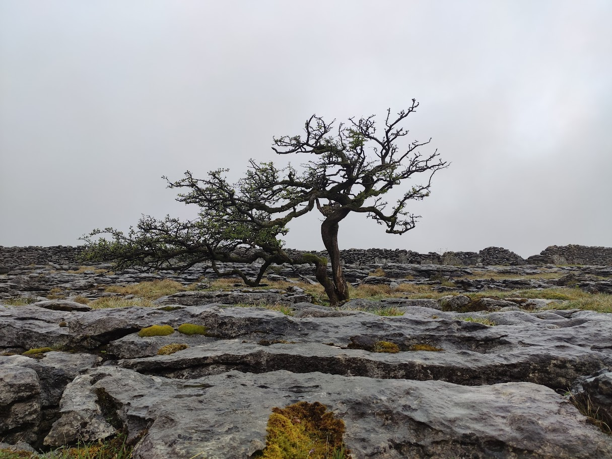
The landscape was made of more rock than earth, and the unsheltered trees looked old and tired.
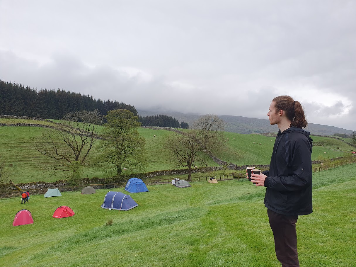
We stopped at The Old Hill Inn but it was too packed for our liking, so moved on to our bed for the night (well, we were carrying our bed for the night, we went to the location of our bed for the night): Philpin Farm Campsite. We remained cold and wet setting up the tent and sleeping through the night, which made the hot chocolate machine in the barn a lot more enjoyable. We spent about as much on hot chocolate as we did for the camping! And the fried egg we had for breakfast the next morning was lovely too. It kept my mind from wondering just how long it would take to develop trench foot...
Me pensively looking off into the distance while holding the sheer ambrosia that was that hot chocolate. Or perhaps I was just nosily watching the other campers.
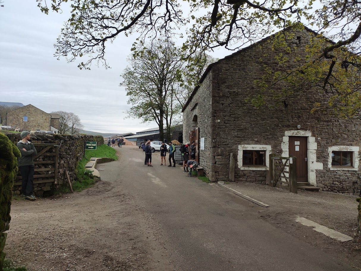
An uninspired view of the campsite barn and through-road while I was waiting for Abbie to have a wee.
Day 2 - Whernside & Pen-y-Ghent
Setting off for Whernside was on day 2 was refreshingly flat, and we found ourselves walking through another farm and a host of inquisitive sheep before reaching the base of the Whernside's ascent. There was no rain and the wind wasn't lashing our faces, so it was a lot more enjoyable than the walk up Ingleborough, albeit a lot more scrambling was involved. There were also an absolute spate of black slugs all over the ground; I'm sure I unknowingly trod on a few here and there. Maybe a squished slug mucus covered rock was the cause of the stretcher incident from the first day... The paths leads up to the ridge which takes you across the top of the mountain. As with Ingleborough, the scenic views were soon replaced by picturesque opaque cloud and mist.
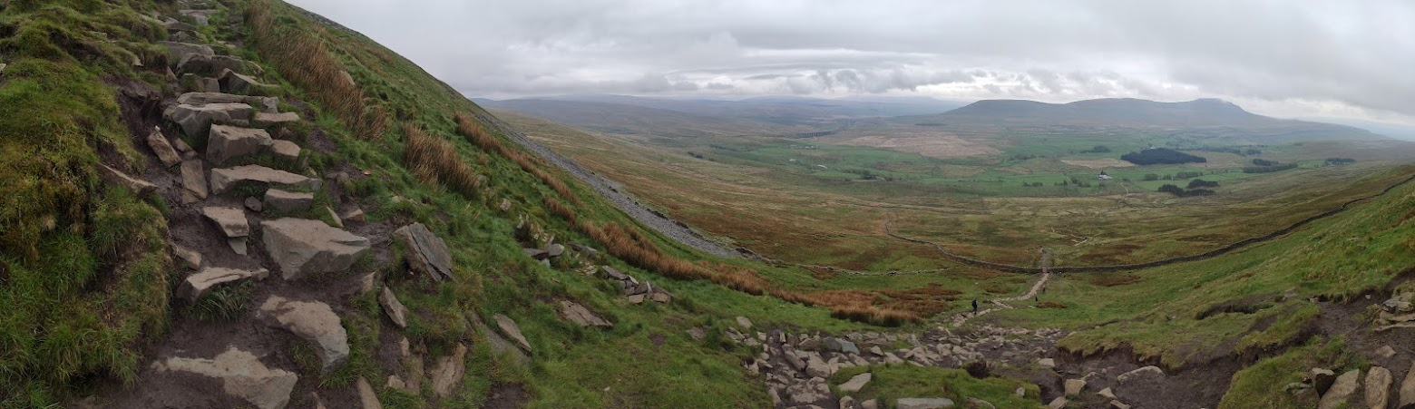
The path up. You can see the summit of Ingleborough on the right there, with the campsite sitting somewhere around the wooded area below.
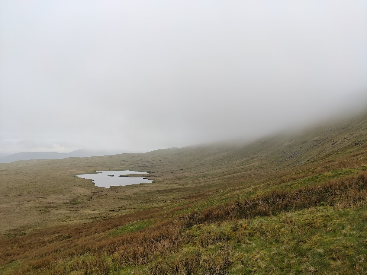
The side of the mountain, before disappearing into the mist.
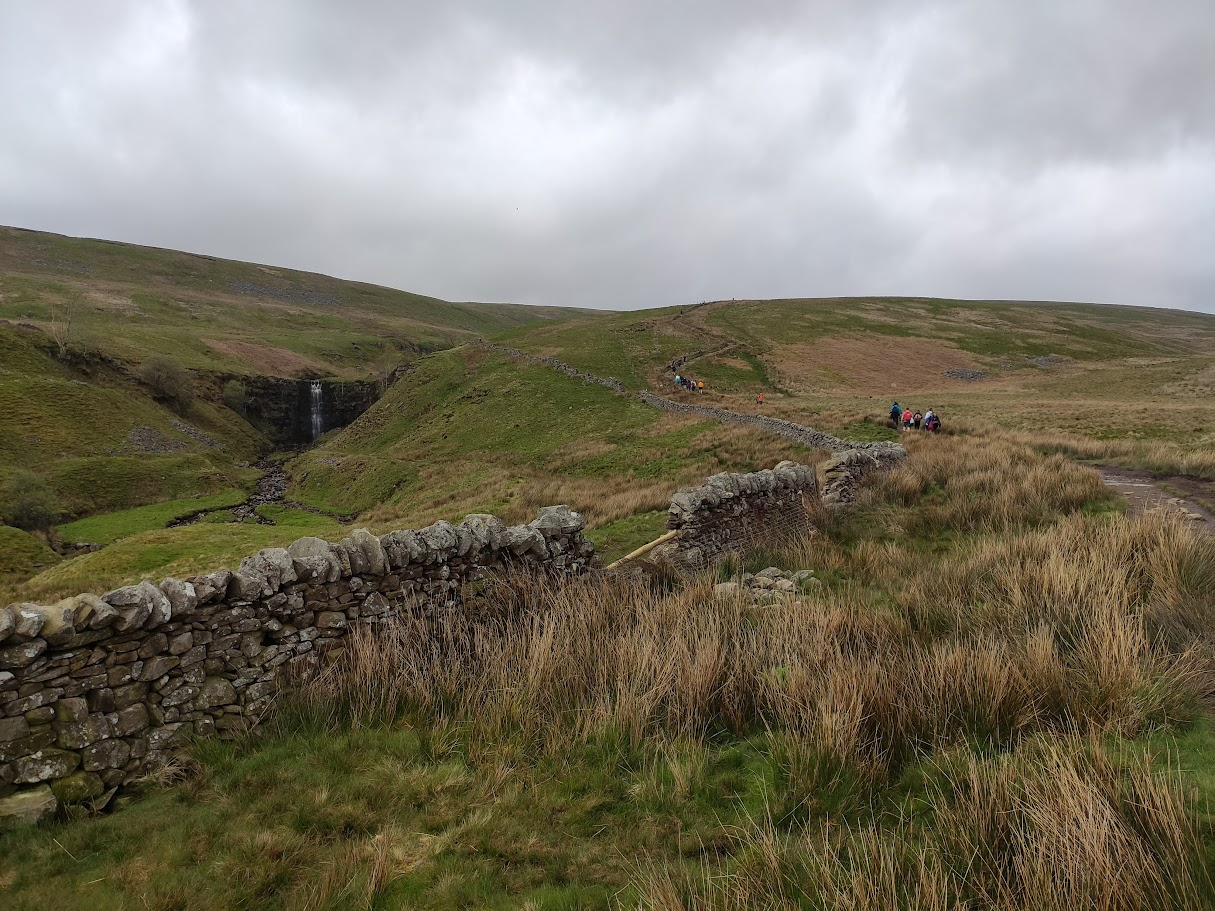
The descent ends up winding in tandem with a river, which has a nice waterfall.
While it doesn't look like it in the above photo, this was definitely the busiest part of the walk. It must just have been the time of day or something. It was also obvious that we were doing it backwards to the conventional route with all the people huffing and puffing up past us while we cantered on down. The ground then levelled out and we found ourselves approaching Ribblehead Viaduct. Completed in 1875, it gave me a sense of appreciation for when people used to design things purely on paper, without CAD or any advanced numerical analyses, back when people had to really think and trust that their design would work. And that is would remain not falling over 150 years later when we walked beneath its arches.
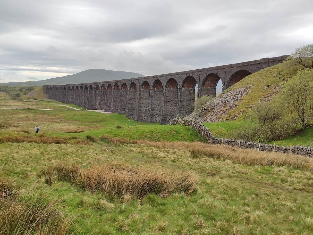
Approaching the viaduct.
While Ribblehead Viaduct is grand and beautiful, its best feature is that it has a pub at the other end.
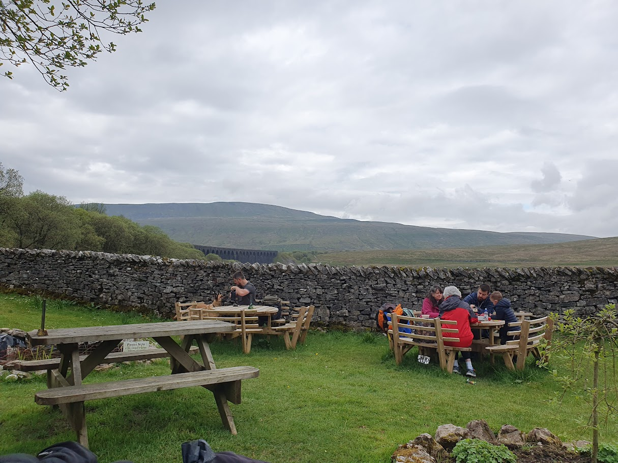
A view from the pub garden.
We drank our wobbly legs back in to action and set off for Pen-y-Ghent. We found ourselves walking along some road and turned off to find ourselves amidst what seemed to be a rather dilapidated farmstead. We continued over a swanky looking bridge and then accidentally took a wrong turn into a private sheep field. Not wanting to turn back on ourselves and endure a walk of shame and extend our adventure, we pushed on and clambered over locked gates as all the other trespassers and criminals of the world do.
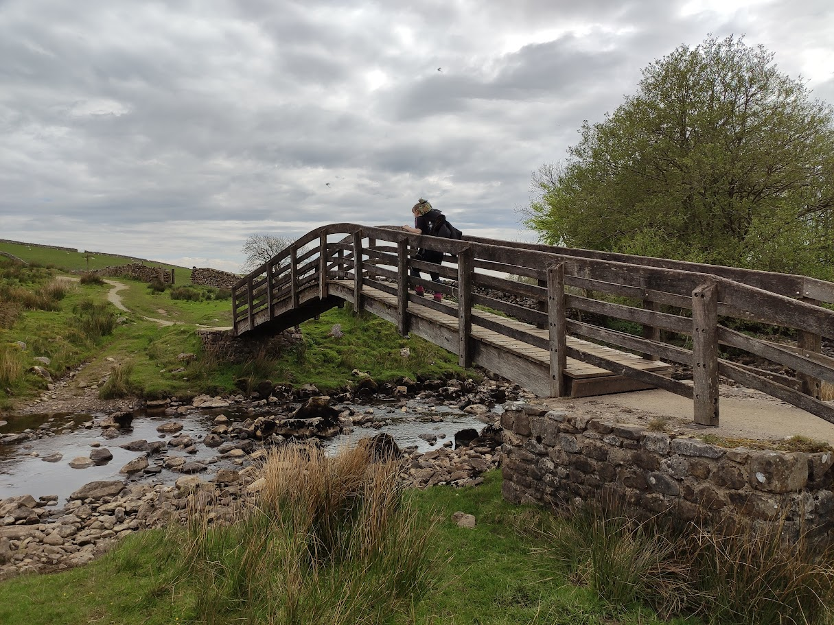
The afore-mentioned swanky bridge.
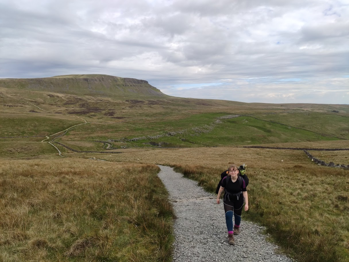
The approach to Pen-y-Ghent. Confusingly, Abbie is walking back towards me; I'm indeed facing the direction of our travels.
The approach to Pen-y-Ghent was very undulating, with more ups and downs than an episode of Poldark. We were pretty spent on our ascent and managed to catch up to another group led by a tour guide, going roughly our pace. We happily attached ourselves to the tail of the group and joined in to any group jeering or shouts of motivation and affirmation. It felt cheeky to attach ourselves to a paid guided group, but we had already assigned ourselves to the gallows by passing through that private sheep field, so we had nothing to loose.
The summit was the only one of the three to have both seating and a distinct lack of mist. It was approaching golden hour, so the views were great with the other two peaks and the viaduct all visible.
Like some poetic full-circle ending to the journey, the descent matched the first day's ascent of Ingleborough in that it was pretty miserable. For different reasons though, instead of unrelenting wind and lashing rain, we had to deal with our unwieldly legs and complaining, cramping muscles. The steepness of the path (which was closer to rock climbing than hiking) was no help either. It's then that we realised why most people go the other way around.
The weather was lovely and calm though, and by the time the terrain evened out, we had one final push of energy, fuelled by the thought that once we got back to the car, we'd be sitting down for a few hours, no more walking or tent-carrying. Speaking of fatigue, a runner passed us going the other way - running up hill! I initially respected him for his fitness and determination, but then realised he actually must have been the village lunatic when he summitted the peak, ran all all the way down and around, and then ran passed us again, for round two! We also witnessed a couple of paragliders who were jumping off the peak; one came right over our heads and I could hear the flapping of his kite.
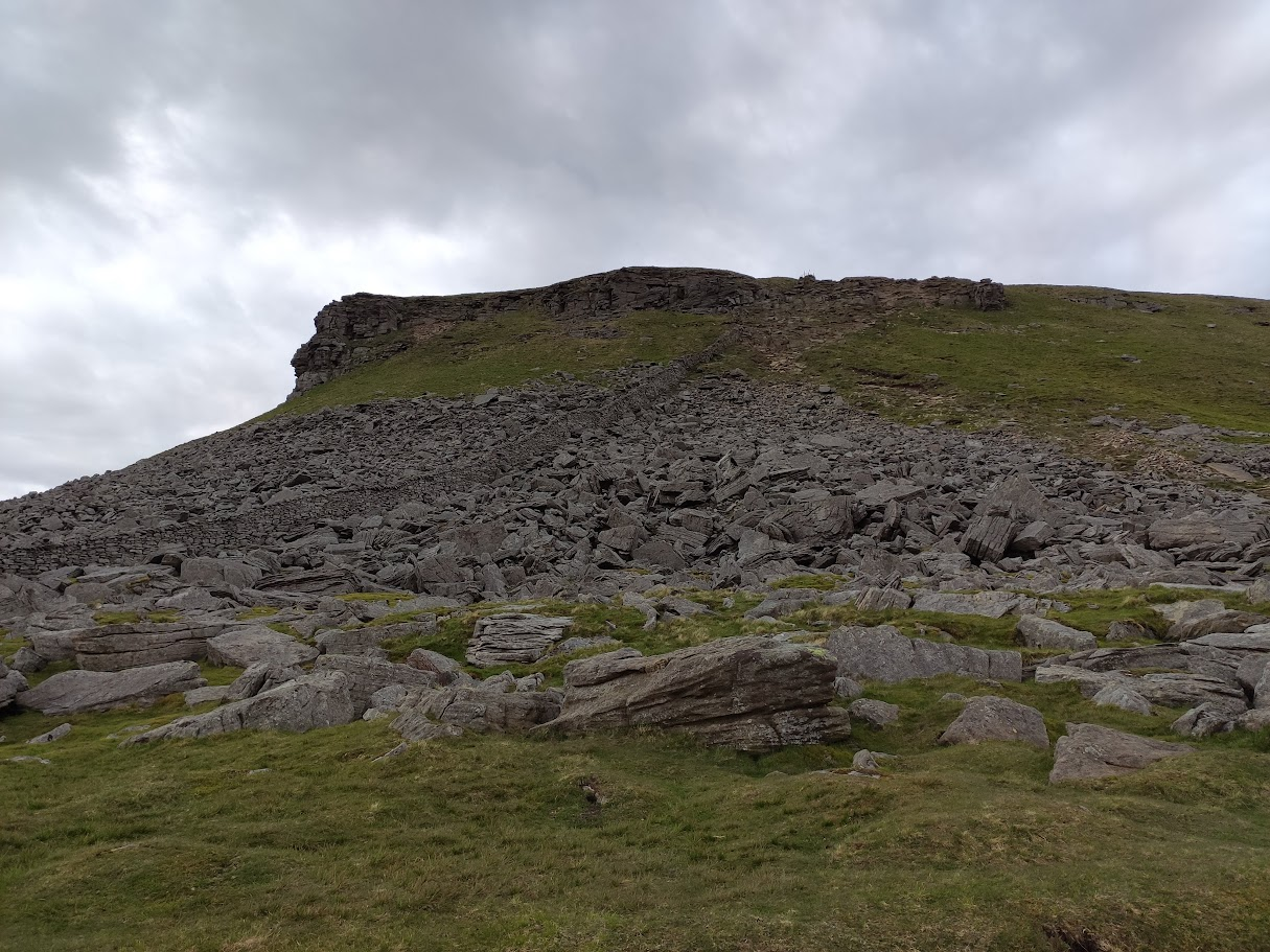
The scrambling scree that is the descent route of Pen-y-Ghent.
We finally got back to Horton in Ribblesdale and walked through back to the car. While tough, it was definitely an enjoyable experience. I'd endeavour to be more waterproof next time though.
Fin.
Thanks for reading!